If you think of the world’s most well-known surf spots, Hawaii or Mexico’s Pacific coast might come to mind. Never had I thought of England as a surf hotspot. So I was genuinely surprised when I arrived in Newquay, on England’s southwest coast, to discover a rabid surf culture. As I traveled through Cornwall, the county that covers the southwestern part of England, I don’t think I’ve come across a more enthusiastic bunch of surf nuts than those found in Great Britain. Having just come from spending three weeks on the Spanish island of Menorca, and being unable to immerse myself in the waters of the Mediterranean Sea in May, I certainly couldn’t conceive of getting into the north Atlantic at the time. Yet folks were happy to don a wetsuit and hurl themselves into the frigid water (55 degrees at the time) in order to spend hours attempting to ride small waves, and some were crazy enough to enter the water – without wetsuits – to swim! Absolutely nuts!
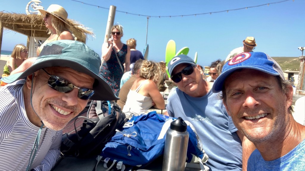
Newquay would be the starting point for a week of walking along the Cornish coast, where I met two old friends (Mark, Matt and I have been doing canoe trips in the Boundary Waters of northern Minnesota for several years) to tackle a section of the South West Coast Path. The SWCP is Britain’s longest national trail, measuring a whopping 630 miles, running from Minehead to Plymouth through three counties on the southern coast. By the time we finished in the town of Penzance, we would cover 88 miles, climb about 15,000 feet (and descending the same amount as we started and ended at sea level) and wonder at the sanity of those crazy Brits and their affinity for cold water.
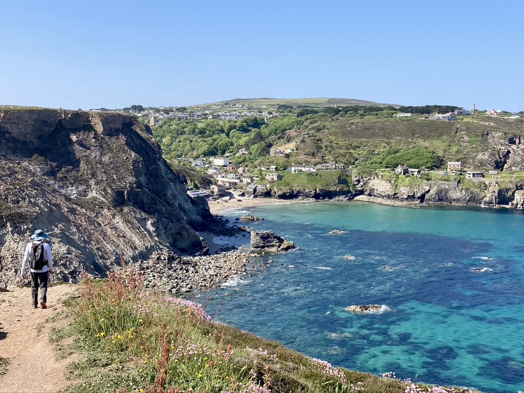
Matt, as he does on our canoe expeditions, handled the logistics of route planning, including making reservations for each of our eight nights of the trip. He also retained the services of a baggage transfer company, who would pick up our large bags from our accommodation each morning and drop them at our next nights guesthouse, allowing us to walk with only a daypack. With a daily distance averaging 12.5 miles, we expected to walk about six hours a day, which would typically have us savoring our first pints by 4pm. After a hearty ‘full English’ breakfast (eggs, bacon, sausage, hash browns, beans, mushrooms, broiled tomatoes, toast, yogurt and muesli) we were fueled for our first days walk. Starting from the center of Newquay the path wound through urban streets, past the small town harbor and then followed a sandy trail squeezed between a golf course and Fistral Beach (‘the home of British surfing!’) before cutting through a peaceful residential neighborhood and eventually bringing us to the Gannel River. We crossed over the river using the ‘ferry’, a small open skiff piloted by a jovial local who runs folks to the opposite bank in the summer, allowing walkers to bypass the 2-mile trek around the Gannel. Leaving Newquay behind we walked through rolling dunes and fields to start what would become the routine for the next week: strolling along wildflower studded cliffs with endless views along the coast before descending down to a stretch of beach or a small rocky cove, then climbing back up again for another session of cliff walking. At the end of our first day we dropped down to Perran Sands, a three-mile stretch of golden sand that led us to the seaside resort town of Perranporth and a well-deserved beer at The Watering Hole before we checked in to our accommodation.
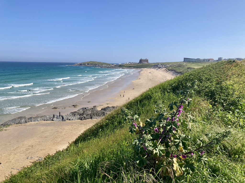
Fistral Beach in Newquay
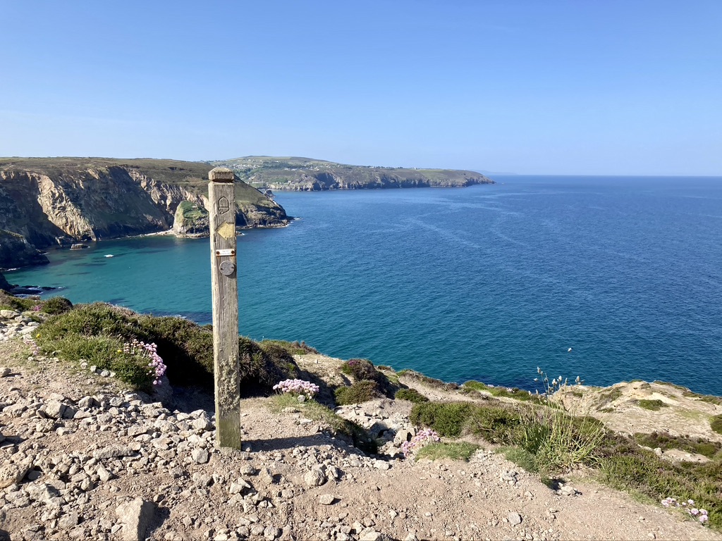
Just follow the acorn – a SWCP signpost
Thirsty walkers at The Watering Hole at the end of Day 1
We wouldn’t be starting every day with the ‘full English’. At the Seiners Arms in Perranporth, I enjoyed avocado toast topped with a poached egg and drizzled with a citrus vinaigrette. A very civilized (and with less arterial stress) way to start day 2. We easily fell into the rhythm of walking the easy paths on the clifftops, brushing past clumps of blooming flowers, including sea thrift, bluebells, foxglove, heather and the small pink flower of Jupiter, which would at times fill entire fields. After striding effortlessly for a mile or so we would come upon a steep descent which would soon be followed by an equally steep climb. By midday we reached Trevaunance Cove and the small village of St. Agnes. Here we would enjoy our first Cornish pasty, a meat-filled hand pie that is one of Cornwalls most famous foods. They would prove to be the perfect lunch item, found in every village bakery, able to withstand several hours of travel in our packs, and both delicious and filling. Pushing on from the pretty cove at St. Agnes we reached our days destination at Portreath, in time for a tasty pint at our guesthouse, the Portreath Arms. While there was plenty of beer on offer, it being a Sunday there was no food available after 3pm. After trying a couple other pubs, and failing to find anyone offering dinner, we settled on the only option available – a Chinese takeout. So rather than fish and chips or a steak and ale pie, we dined on pork with beansprouts, sweet and sour chicken, beef and mushrooms, fried rice and prawn crackers.
Mark leads the way down to Trevaunance Cove

Sea thrift lines the path
Day 3 had quite a bit of cliff walking, a trip around Godrevy Point past it’s pretty island lighthouse, then a fair bit of traipsing through the Upton Towans, the hummocky dunes behind Gwithian Beach, before finishing the day with a barefoot stroll along the sand of Hayle Beach, which brought us right into the town of Hayle and our stop for the night at the White Hart Inn. Offering a cozy pub and decent dining room, we saw no reason to leave the premises this night. The following morning we departed Hayle, walked through the charming, leafy village of Lelant before hitting the coast again. Next came Carbis Bay, tucked onto a steep slope above the bay of the same name before entering St. Ives, the most touristy town we encountered in the week. It was a weeklong school holiday, and the narrow cobblestone lanes of town were crammed with families headed to or coming from one of the three beaches bordering town. We stopped briefly at a bakery to pick up sandwiches before continuing on to a spot above Clodgy Point, where we sat on a grassy slope above the sea to have lunch. The day would end at the village of Zennor, lying about a mile inland from the path, with a pint of local beer at the Tinners Arms, before walking through cow pastures to reach our beds for the night at a farmhouse B & B just outside town.
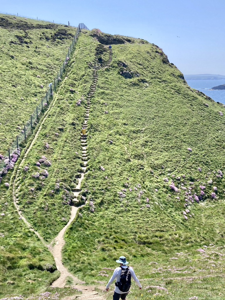
What goes down must go back up . . .
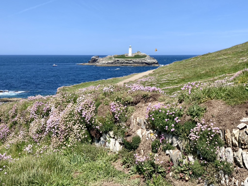
A view of the Godrevy Point lighthouse

The only thing(s) between me and my pint at the Tinner’s Arms
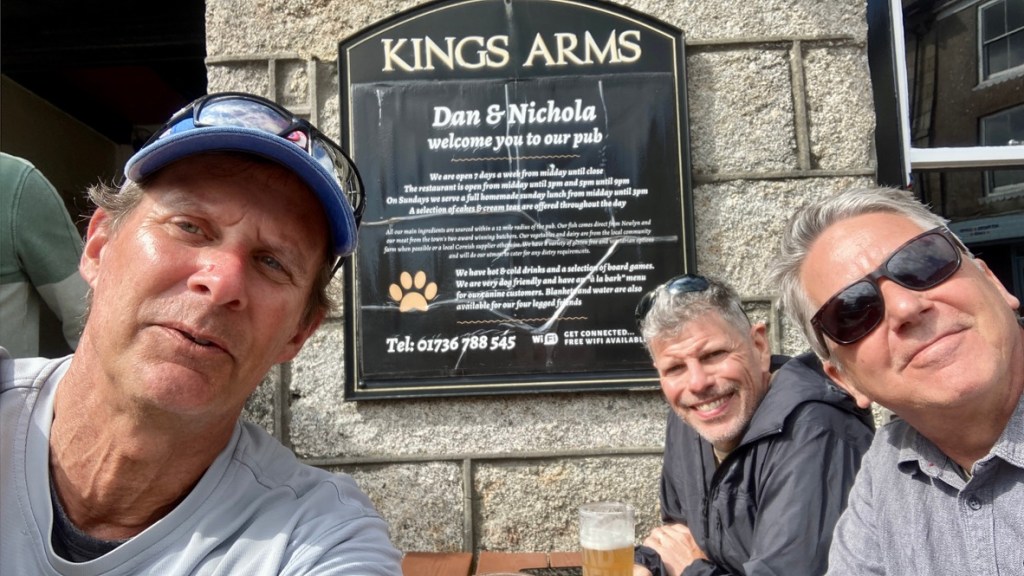
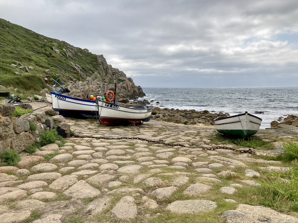
Leaving Zennor the next morning, a friendly farmer pointed out a shortcut through his property that took us back out to the coastal path and we were on our way past Gurnard’s Head, Porthmeor Cove and the Pendeen Lighthouse before stopping for lunch at a cafe outside the Geevor Tin Mine. We had entered the ‘Tin Coast’ of Cornwall, with much of the next two days passing the ruins of the areas mining heritage. We ended the day in St. Just, joining the locals for a few pints at the King’s Arms, relishing the sunshine from the tables outside overlooking the town square. Day 6 would take us around Land’s End, England’s westernmost point, and what turned out to be a mostly disappointing over-commercialized fun park. Folks were lined up to have their pictures taken at the Land’s End sign, the fudge shop was doing a brisk business and, if one wanted to, indoor mini-golf was on offer, along with a petting farm and a pirate museum. We quickly pressed on and soon left the crowds behind to enjoy the quiet of the clifftop and fields of flowers before descending to the small village of Porthcurno, our next-to-last stop, and our room at the Seaview House B&B. Tiny Porthcurno had no pub or restaurant, so we had to call a taxi to take us to the nearby village of Treen, where we found the popular Logan Rock Inn and it’s sunny garden. A couple rounds of beer were followed by an outstanding meal of crab bisque and grilled mackerel.
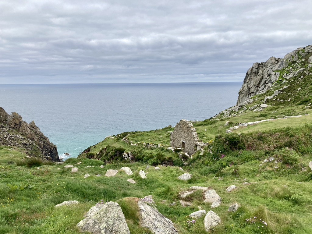
The ruins of a cottage outside St. Just
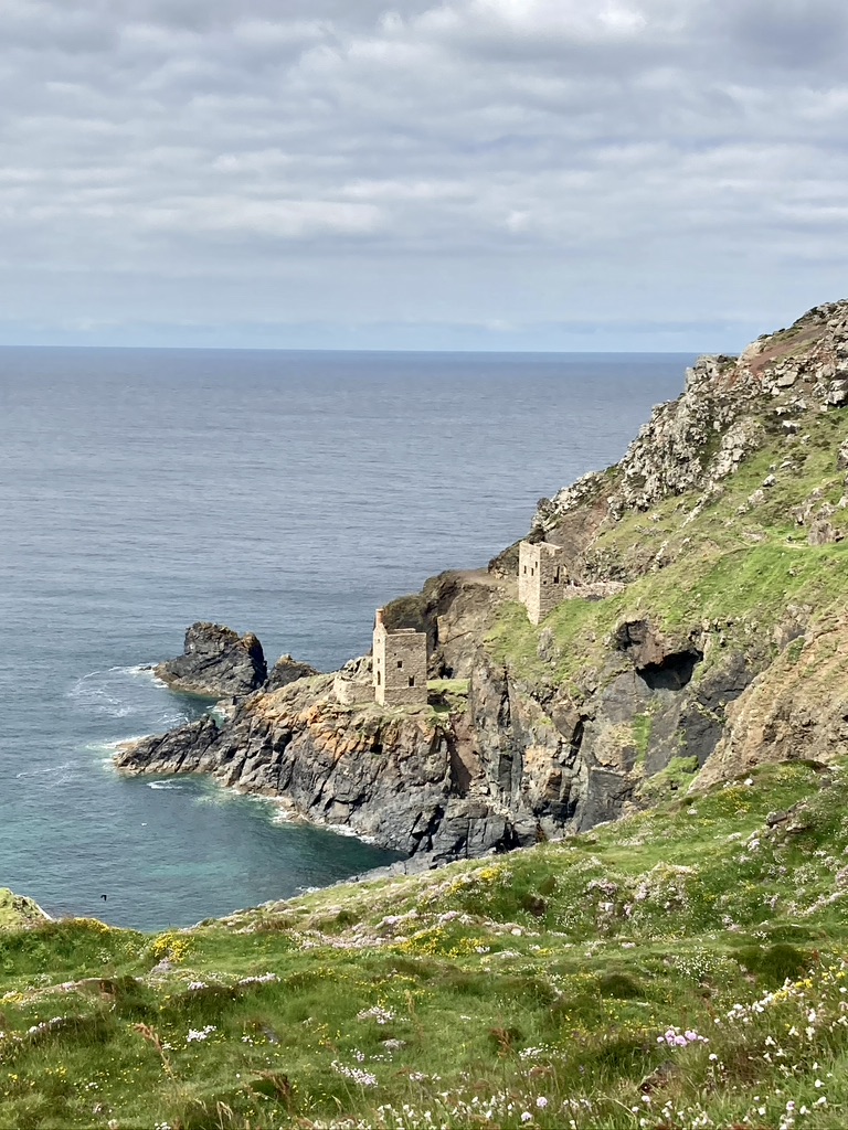
Remnants of the mining heritage along the ‘Tin Coast’
The best part of the day
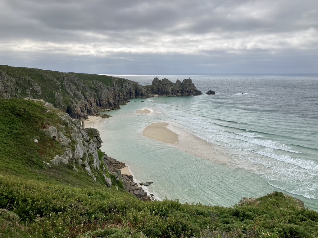
Looking down on a cove outside Porthcurno
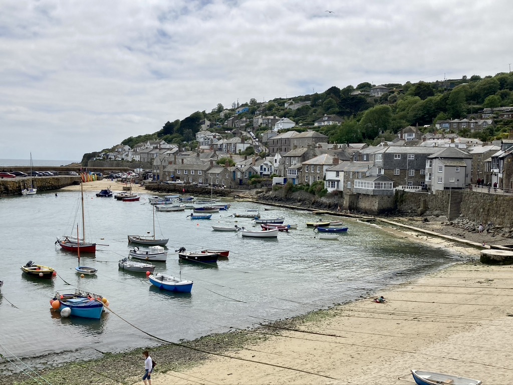
Our final day began with a climb out of Porthcurno to follow the cliffs before descending to the incredibly quaint hamlet of Penberth Cove, consisting of a cafe and a handful of cottages situated amongst a riot of colorful flowers. Several more climbs and descents reminded us we weren’t quite done yet, but after the final drop down to pretty Mousehole, we finished on four miles of pavement through Newlyn and into Penzance, ending at the comfortable pub at the Longboat Inn. The following day we would go our separate ways – Mark returning to Washington D.C., Matt and his wife heading south to Portugal, and I would make my way home to Colorado to be reunited with Heather, where all the fabulous recreation opportunities of a summer in the Rockies awaits.
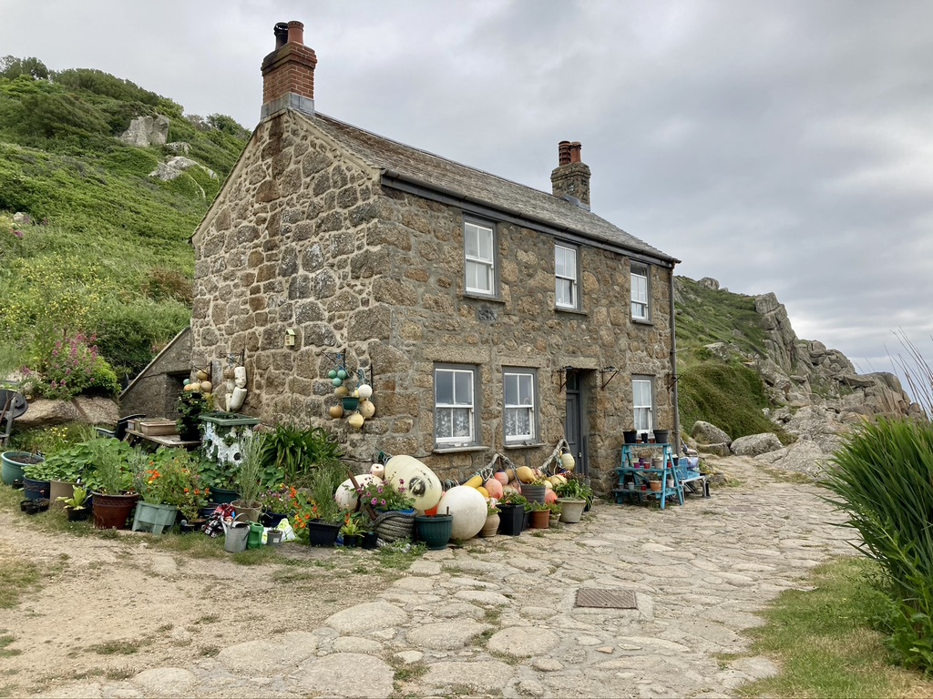
A fisherman’s cottage in tiny Penberth cove
Looking out from Penberth Cove
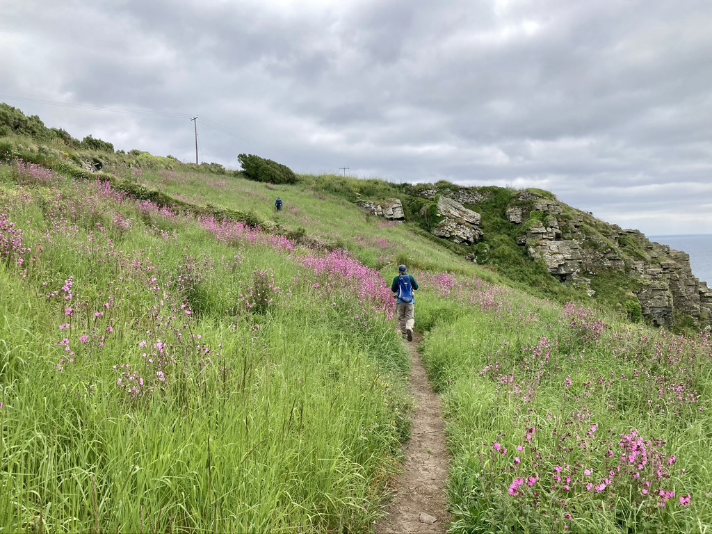
A last stretch through a field of Flower of Jupiter
Mousehole, where the trail ended and the pavement began – only four more miles to Penzance!
