“We don’t talk about east and west in Chile, only north and south.”
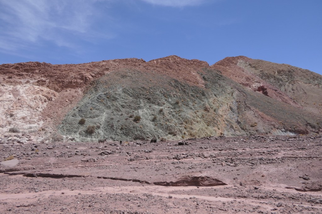
That, from a Chilean couple dining next to us one morning, was an apt description of Chile’s geography – long and narrow and pinched between the Pacific Ocean and the soaring peaks of the Andes. Stretching for 4,000 miles from the Peruvian border in the north down to Cape Horn and the Straits of Magellan in the south, and no more than 110 miles wide, one only needs to travel north and south to see the country. We began our visit up north, after flying into Santiago, the capital, and connecting to a domestic flight to Calama before picking up our rental car and heading out to the Atacama Desert for a few days of exploration. San Pedro is the only town of any size in the Atacama, home to the lodges, tour operators and restaurants that host and serve the visitors looking to explore the surrounding desert. Highway 23 runs from Calama through San Pedro before turning to the frontier with Argentina. Along its path a number of lesser traveled (and lesser-paved) roads head out to the various attractions lying in the barren expanse of the Atacama Desert. When we left Calama on day 1, we turned off Highway 23 to explore Valle de Arcoiris – Rainbow Valley – passing through a gray landscape of bare rock and sandstone, occasionally spotting small herds of guanacos – a relative of the llama – before descending down to the Rio Salado, which flowed into the Valle de Arcoiris. After stopping at the ranger station at the head of the valley and paying our entrance fee, we drove into the valley to stop at a number of parking areas to explore and take in the views of the multi-colored rock formations. After our visit we backtracked to the highway and continued on to San Pedro to check into our accomodation and get a meal in town. San Pedro is best described as . . . dusty. By late afternoon, as the wind blows swirls of red dust over everything, visitors fill the dirt streets of the main pedestrian area, looking to book the next days tour at the slew of outfitters offices, slake their thirst at a bevy of drinking establishments or fill their bellies with steaks, burgers, pizzas, pastas, ceviche or seafood. The culinary offerings are extensive, with a heavy dose of Italian and Peruvian influences.
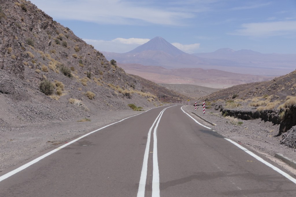
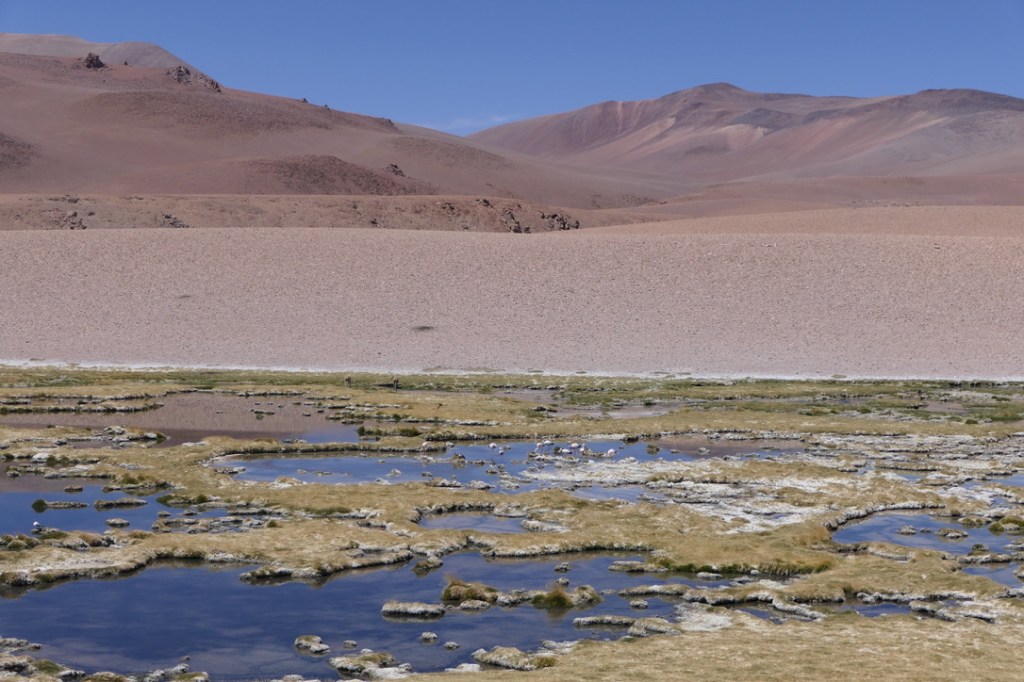
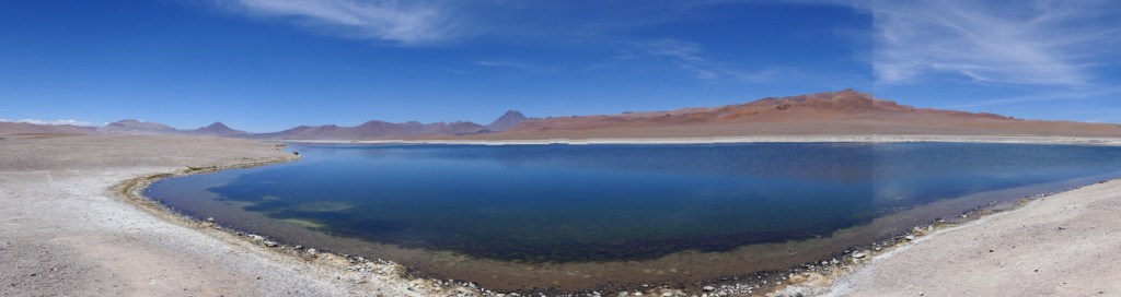
On our second day, we drove east from San Pedro headed to the Reserva Nacional Los Flamencos, lying on a high-altitude plateau abutting the border with Argentina. After climbing from town we passed a series of volcanic peaks before eventually reaching the reserve. A small wetland area hosted dozens of guanacos, flamingoes and ducks, a respite of water and green space tucked between the dry rocky peaks of the Andes. A half hour further took us to two more lagunas, or salt lakes, at the center of the reserve. Here too we spotted guanacos feeding on the sparse grasses at the edge of the lakes and flamingoes wading in the shallow waters.
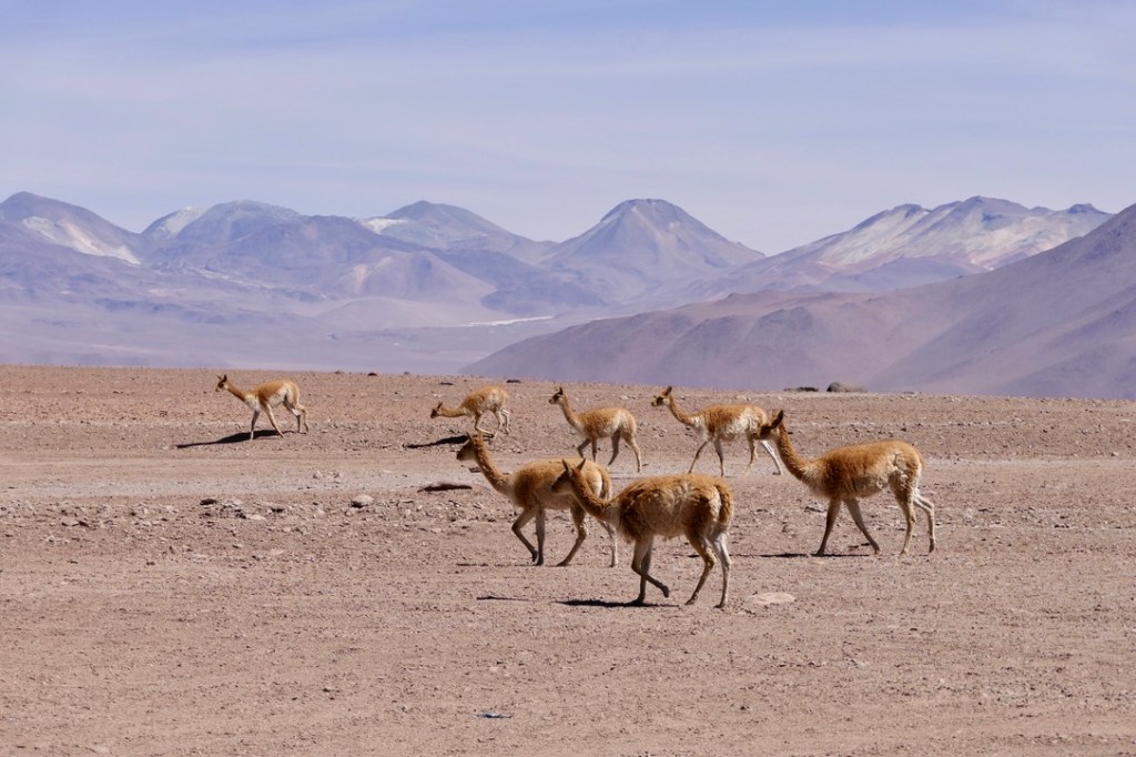
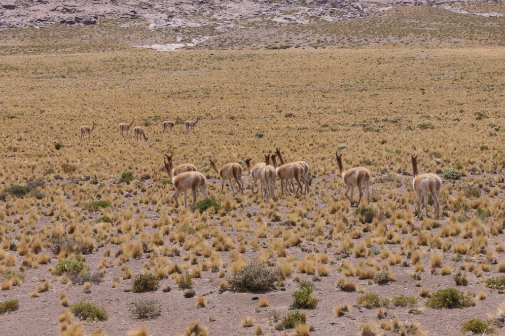
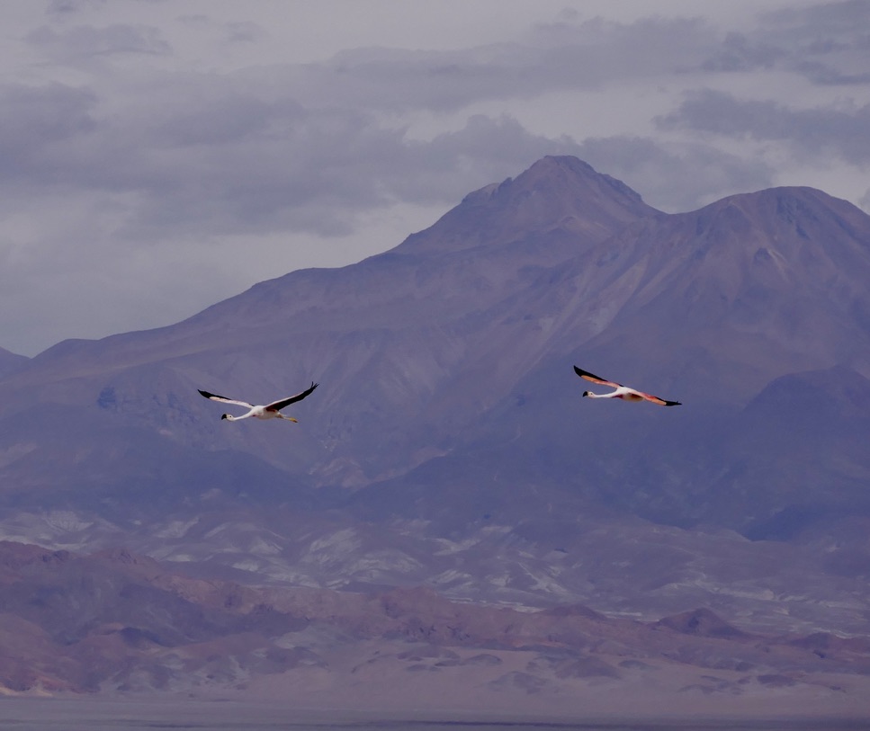
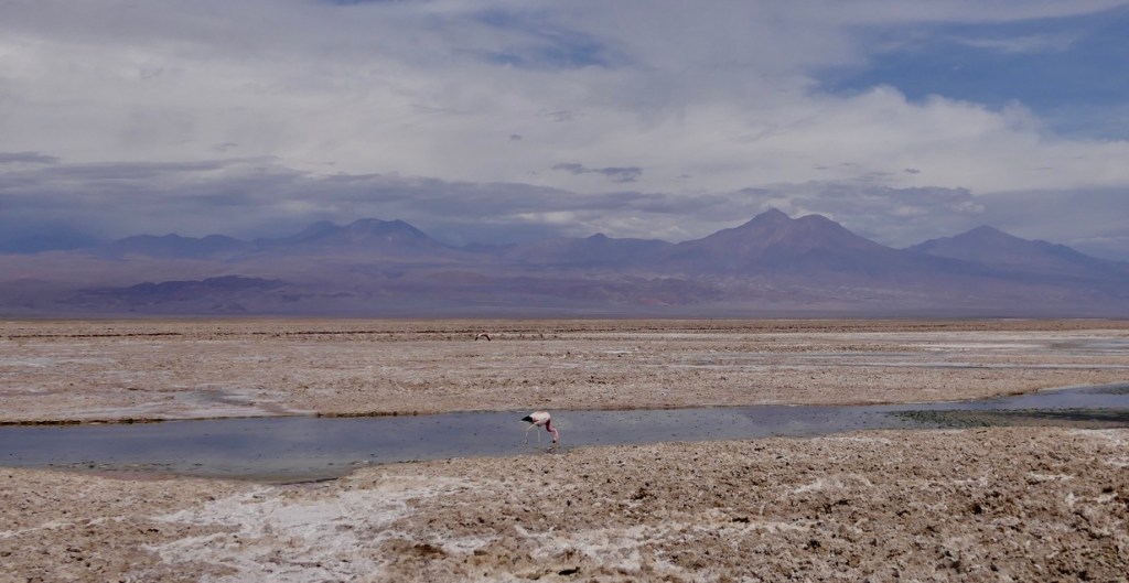
The next day we drove south for a couple hours, climbing to an altitude of 13,500′ before reaching the lagunas altiplanicas, or high-altitude lakes, of Miscanti and Miniques. Set at the base of yet more volcanic peaks, the lakes hosted a herd of vicunas, a relative of the guanaco, as well as flocks of flamingoes. Leaving the park we wound down the road through meadows of short grasses and yellow flowers, eventually reaching the desert floor and heading back north towards San Pedro. Just past the town of Socaire, we turned off the highway and headed towards our next stop, the salt flats of the Parque Laguna Chaxa. The floor of the desert here was streaked with white – the salt remaining behind after what little water had made its way down from the surrounding mountains to evaporate from the basin of Laguna Chaxa. In the small lakes that remained on the desert floor, dozens of flamingoes stalked through the briny water to feed on the shrimp larvae that existed there, and which provide the pinkish hue to the birds feathers.
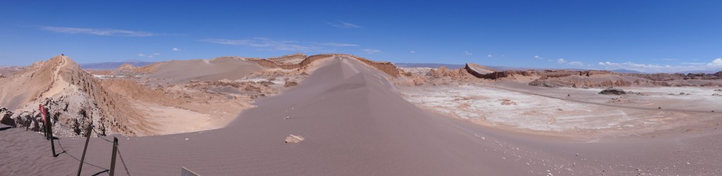
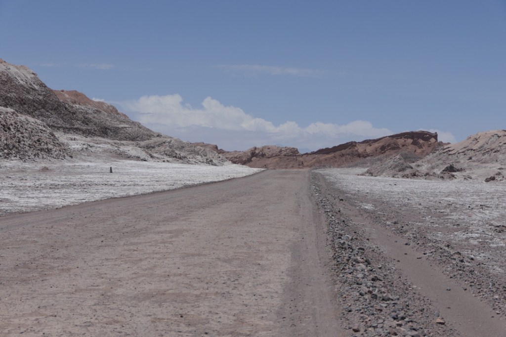
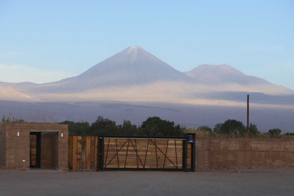
Our final day in the Atacama took us to Valle de la Luna – the Valley of the Moon – and it’s otherworldly landscapes of black volcanic sands, red rocks and salt-encrusted valley floor. We explored massive dunes, looked out over ravines carved by ancient waterways and marveled at the total absence of any living thing – no plants or animals could possibly exist in such a bleak landscape. Upon our return to town, we enjoyed cold drinks in the shaded courtyard of a restaurant and dined on ceviche before heading out to our guesthouse on the edge of town to watch the sunset against the slopes of the Licancabur Volcano.
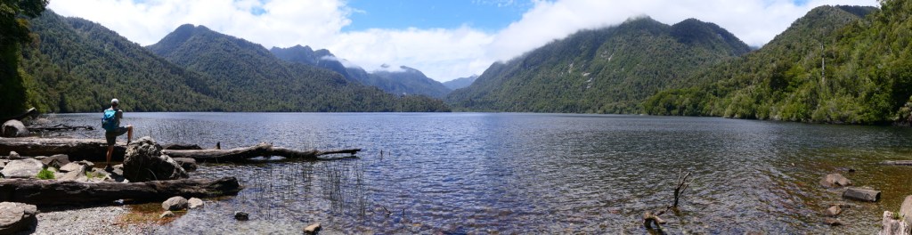
The drive back to Calama gave us our last glimpses of the desert landscapes before boarding our flight to Puerto Montt in the Lakes District of south-central Chile. This is where volcanoes meet the lakes, wild rivers entertain rafters, thick forests of the national parks host a network of trails and quaint and peaceful lakeside towns provide a base for travelers. Puerto Varas is one of these towns, stretching along the southwestern shore of Lake Llanquihue, offering perfect views of three snow-capped volcanoes on the lakes eastern side, a German immigrant heritage and a quaint European vibe featuring modern alpine architecture alongside older wood-shingled homes containing gardens bursting with flowers and a downtown area lined with blooming roses. A pleasant waterfront promenade runs for nearly two miles, and the black sand beaches along its length fill with Chilenos on summer weekends. On a drive around the lake we visited the Osorno Ski Center located just below the cone of the Osorno volcano, stopped to peruse the roadside shops that offered local honey, jam, cheese and woolen products and enjoyed a delicious lunch in Puerto Octay, a town on the lakes north shore founded by German immigrants in the mid-19th century. Another day took us back to the lakes eastern side to view the waterfalls at Petrohue in the Vicente Perez Rosales National Park, a visit to Lake Todos Los Santos and an incredible lunch of pan-seared salmon (farm-raised in the lake) at a restaurant back on the shores of Lake Llanquihue. Venturing further south we visited Alerce Andino National Park for a walk through the forest to Lake Sargazo before finishing the day at Cerveza Bosques, a craft brewery set in the forest (bosque) just outside Puerto Varas. In town we also found Mesa Tropea, another craft brewery, this one set in an old warehouse built on stilts right over the lake. Our final night in lovely Puerto Varas we visited Delicias – an old-school steak house where I indulged my carnivorous habits by feasting on a ribeye steak alongside a mound of mashed potatoes (studded with caramelized onions and roasted peppers), a glass or two of Chilean red wine and a dessert of baked custard.

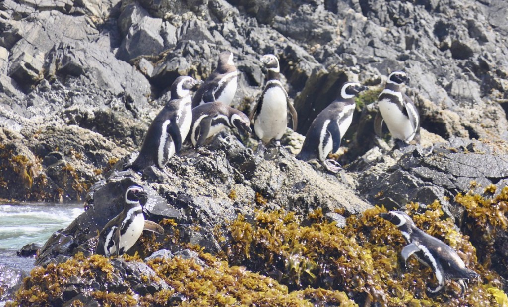
Driving a couple hours south from Puerto Varas took us to Chile’s largest island – Chiloe, at the heart of the Chiloe archipelago in the Pacific Ocean. The island is known for its pastoral landscapes – gentle rolling hills, pastures hosting cattle and sheep, remote villages where residents sold homemade cheeses from their farmhouses, and a series of wooden churches built by Jesuit missionaries in the 17th and 18th centuries. Another attraction of the island is the chance to see wildlife – on the northwest coast small offshore islets host colonies of penguins. Arriving on the beach at Punahuil, we parked and purchased our tickets for a visit to the penguineras. Offshore several rocky islets hosted small groups of Magellanic and Humbolt penguins, stoically braving the bracing winds and chilly waters of the southern Pacific.
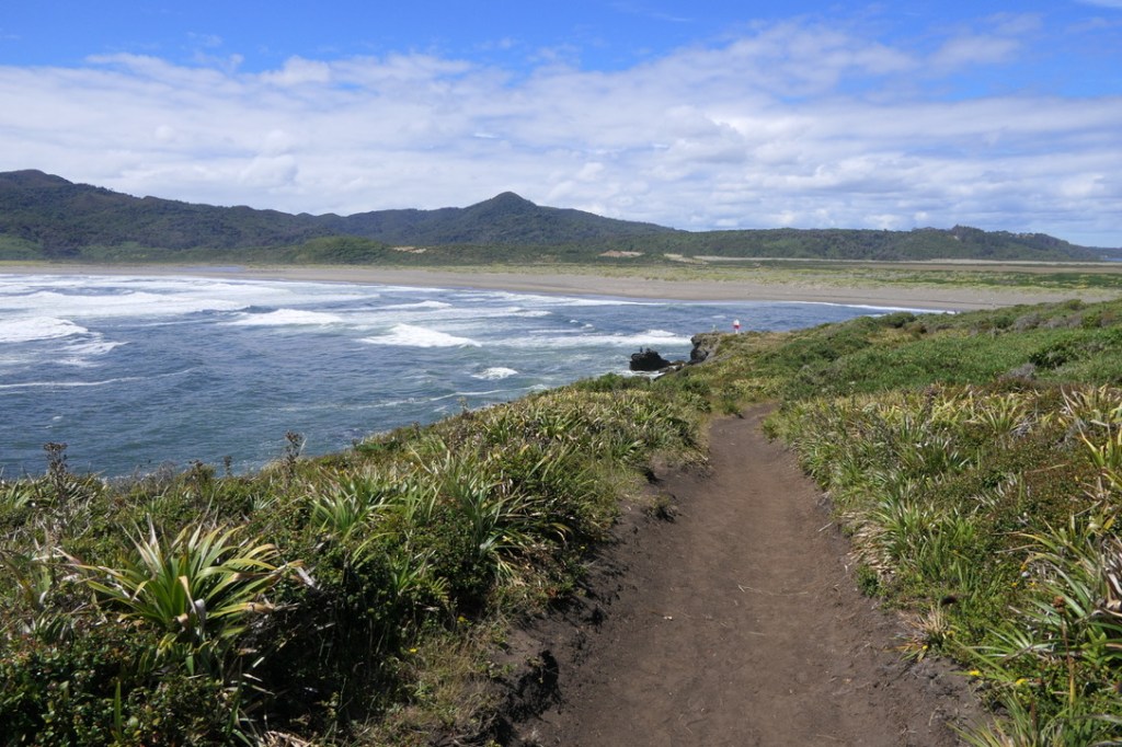
After our visit to the penguin colonies we took a drive to Mar Bravo, a long sandy beach backed by pastures where groups of cattle and horses grazed. During our walk along the beach both the horses and cattle ventured down to the beach to frolic on the sand and move to other pastures. At the end of the beach we found basalt cliffs towering over the sand, a remnant of the areas volcanic past.
Completing our visit to Chile’s lakes region, we headed further south to one of our “bucket list” destinations – Patagonia. That story in the next TheRhumline.
